Walking and running
I've always enjoyed walking and running. I think better when I'm in motion. And I appreciate the general minimalism of the experience. It's also a reason I enjoy one-bag travel. Not too much equipment and more self-sufficient.
I started recording my walks in the fall of 2023, with the goal of trying to walk or run every street in Seattle. Luckily, there's some tools for tracking this, especially CityStrides. It takes in logs from Strava and other sources, shows a map, and gives a completion percentage, based on the % of routes where you've covered all the vertices on the route. It's a fun site, but it never quite gave me the perspective or level of detail that I wanted.
I started running pretty regularly in August of 2025. Partly it was a health thing, partly it was wanting to do some races, and partly it was motivated by wanting to cover more of the city faster. I think this combination of motivation was critical for sticking with it - but whatever it was, it's worked.
As with other areas of my life, I do like quantification and tracking. I remember getting tourist maps from information centers on my first trips to Europe, and then in the evening in a hostel or hotel trying to retrace the route I walked through the city with a pen on the map. Even at that point I wanted to make a deliberate effort to see new streets and neighborhoods. It was also good way to build spatial memory although I don't think I was very accurate for many of the streets. I've built a tool that helps produce the kind of visualizations that I wanted.
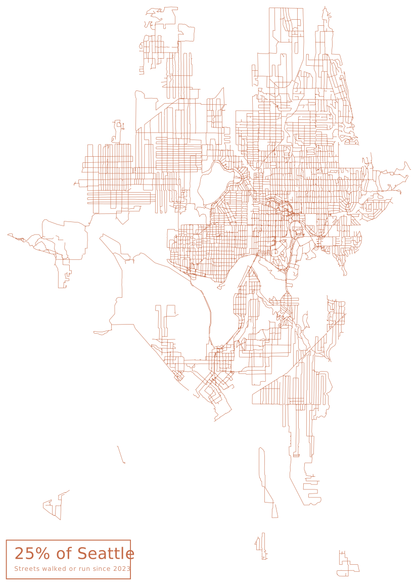
Coincidentally, as of July 2026 I've covered just over 25% of Seattle streets (in about 2 years 9 months). You can see the 25% that I've selected so far. Mostly in North Seattle, but I'm now making progress on Central Seattle, and then South Seattle is up (the map doesn't show the full Seattle city bounds at the southern extent, there's nothing I've covered down there). Generally I've preferred flatter terrain and more gridlike areas for my coverage numbers - it's easier to track during a run. Likewise, I don't like industrial areas or large commercial zones as much (such as Northgate) so these have lagged a bit.
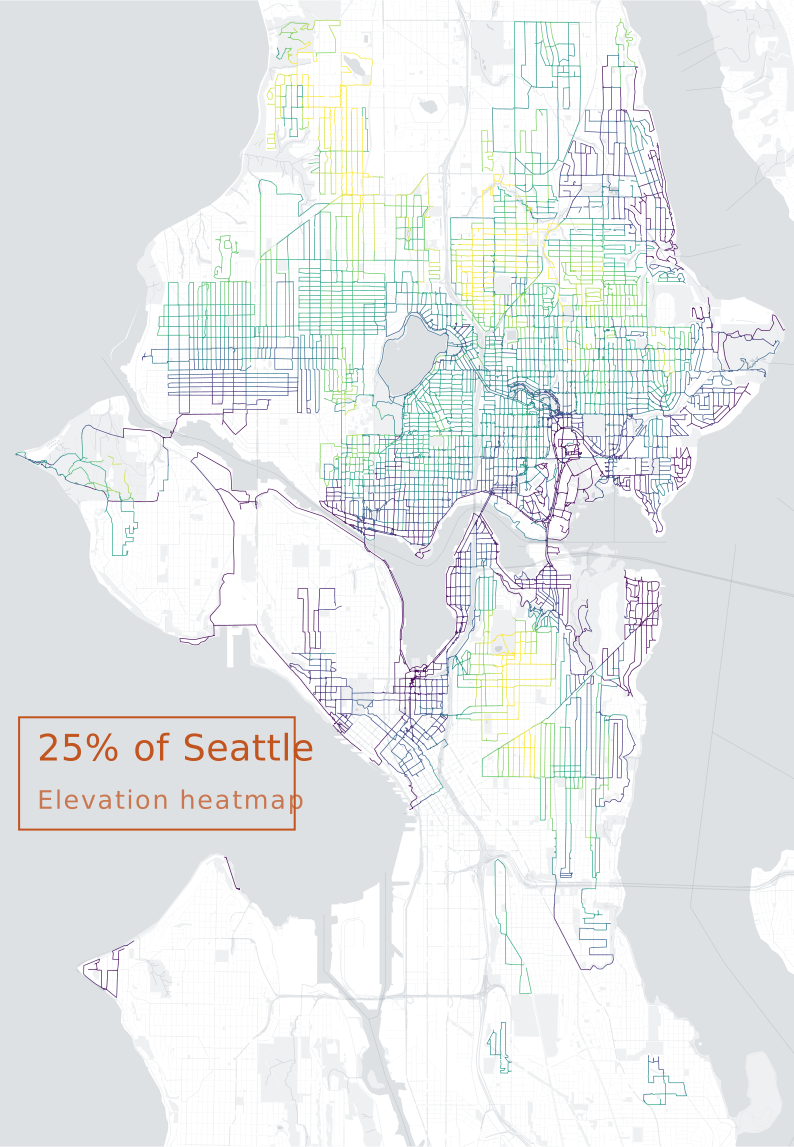
I enjoy mapmaking and cartography, so I also view this as a sort of personal mapmaking experiment and an information visualization experiment as well. Above, you can see my personal road elevation heatmap of Seattle streets.
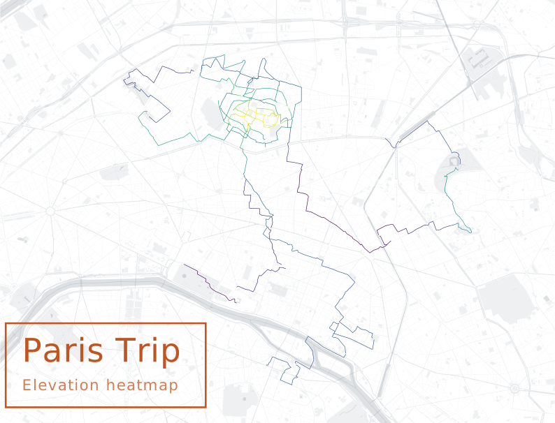
This is also a fun way to memorialize trips. As an example above, you can see where we walked in the Montmartre area (and city center) during a trip to Paris for a few days.
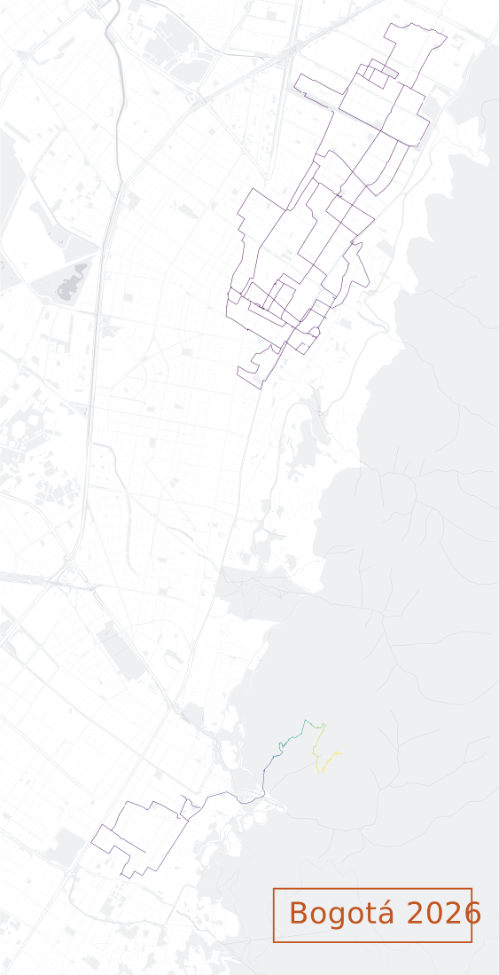
Or (above) the areas that we walked in Bogota (including a very steep Monserrate hike).